Iowa Crop Progress and Condition Report — Week of July 13
Released by the USDA National Agricultural Statistics Service
Iowa Secretary of Agriculture Mike Naig commented on the Iowa Crop Progress and Condition Report released by the USDA National Agricultural Statistics Service. The report is released weekly April through November. Additionally, the Iowa Department of Agriculture and Land Stewardship provides a weather summary each week during this time.
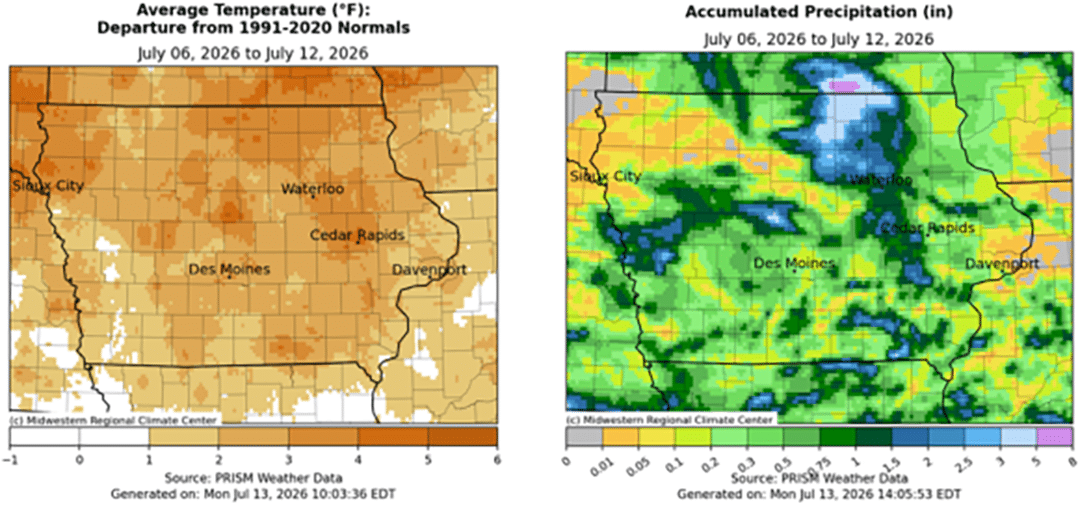
“After the wettest week of the growing season for much of the state, the weather settled into a warmer, drier pattern, which could continue for the next seven to ten days. Soil moisture reserves and timely rainfalls will be needed to support the corn crop as it enters the critical tasseling and pollination period,” Secretary Naig said. “As county fair season continues across Iowa, I encourage everyone to get out and support these great community events while celebrating the achievements of our outstanding 4-H and FFA youth exhibitors.”
Crop report
There were 5.4 days suitable for fieldwork during the week ending July 12, 2026. This is 1.6 days more than last year, when there were 3.8 days suitable for fieldwork. Topsoil moisture condition rated 1 percent very short, 14 percent short, 73 percent adequate, and 12 percent surplus. Subsoil moisture condition rated 3 percent very short, 18 percent short, 69 percent adequate, and 10 percent surplus. Corn silking in Iowa reached 38 percent, which is 5 percentage points ahead of last year. One percent of Iowa’s corn crop reached the dough stage, which is 4 percentage points behind last year. Corn condition rated 78 percent good to excellent. Soybeans blooming reached 56 percent, which is 5 percentage points ahead of last year. Soybeans setting pods reached 16 percent, which is 1 percentage point behind last year. Soybean condition rated 74 percent good to excellent. Oats headed reached 98 percent, which is 2 percentage points ahead of last year. Eight percent of oats have been harvested, which is 10 percentage points behind last year. Oats condition rated 81 percent good to excellent. Pasture condition rated 73 percent good to excellent.
The weekly report is also available on the USDA’s website at https://www.nass.usda.gov/.
Weather summary
Provided by Justin Glisan, Ph.D., State Climatologist, Iowa Department of Agriculture and Land Stewardship
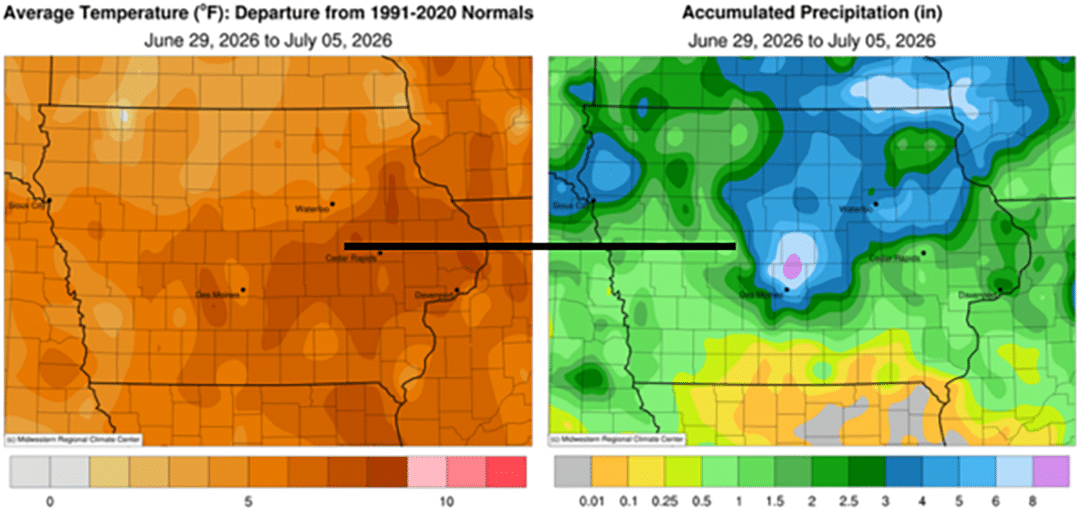
Thunderstorm activity across the state was much tamer than in recent weeks with unseasonably dry conditions over much of Iowa. Only stations in north-central Iowa reported positive departures in the range of 2.00-4.00 inches. Temperatures remained warmer than average, though moderated from last week; the statewide average temperature was 77.4 degrees, 2.4 degrees above normal.
Poor air quality gradually improved through Sunday (5th) afternoon as variable, light winds increased under mostly sunny skies and temperatures in the low to mid 80s. Spotty thundershowers formed in eastern Iowa towards the evening hours, leaving behind 0.21 inch of rain in Ottumwa (Wapello County) and 0.23 inch in Nashua (Floyd County). Patchy fog was reported from western to southeastern Iowa around sunrise on Monday (6th) with morning temperatures in the upper 60s and low 70s. Daytime conditions were mostly sunny with highs in the mid 80s with southerly to easterly shifting winds west to east across the state. A cluster of storms pushed into north-central Iowa in the hours before sunrise on Tuesday (7th), though the complex quickly dissipated. Totals were very isolated with only a handful of stations observing rainfall; Estherville (Emmet County) registered 1.07 inches to 1.20 inches in Swea City (Kossuth County). Partly sunny skies developed into the afternoon with temperatures in the mid to upper 80s and light winds. Clouds hung around into Wednesday (8th) as winds shifted to a southerly direction. Showers and thunderstorms skirted the Iowa-Minnesota border during the morning hours as southerly flow pumped low-level moisture into the Upper Midwest. Afternoon temperatures returned to the 80s with dew points pushing into the 70s. A surface front moved into the unstable airmass over the evening hours, firing a line of strong thunderstorms in northeastern Iowa with broken segments in western to central Iowa; several 60-mph wind gusts were observed. The line consolidated as it moved southeast with additional development in west-central Iowa. The complex fell apart by 7:00 am on Thursday (9th), with the highest amounts occurring across central and northeastern Iowa. Rainfall totaled 2.33 inches in Ames (Story County), while totals at three gauges in Osage (Mitchell County) ranged from 3.32 to 4.79 inches. A swath extending from east-central to western Iowa also registered 0.75–1.25 inches of rainfall.
Afternoon temperatures were seasonal in the low 80s, with lower relative humidity and mostly cloudy skies. Scattered thundershowers developed over eastern Iowa and persisted into Friday (10th) morning. Additional showers moved through southern Iowa as a low pressure center pushed through northern Missouri. Atmospheric conditions in the afternoon hours were conducive to funnel clouds across northern and eastern Iowa; a brief touchdown was reported near Swaledale (Cerro Gordo County). Thunderstorms continued to pop up over southern Iowa after midnight before moving off as the disturbance traveled east. South-central and southeastern stations reported the most rainfall with 1.40 inches in Murray (Clarke County) and 2.46 inches in Ottumwa. Most stations reporting rainfall had at least a few tenths of an inch. Saturday (11th) was a pleasant, sunshine-filled day with highs in the low to mid 80s and light easterly winds. Starry skies held into Sunday (12th) morning with temperatures in the mid to upper 60s and patchy fog.
Weekly precipitation totals ranged from no measurable amounts at multiple eastern and northern stations to 4.88 inches in Osage. The statewide weekly average precipitation was 0.66 inch; the normal is 0.97 inch. Lamoni (Decatur County) reported the week’s high temperature of 93 degrees on the 8th, six degrees above normal. Greenfield (Adair County) reported the week’s low temperature of 53 degrees on the 11th, 11 degrees below normal.